Fansipan Mountain
The topography of Fansipan Mountain is varied. Muong Hoa Valley, at the lowest altitude (950 – 1,000m), is created by a narrow strip of land at the base on the east side of the mountain
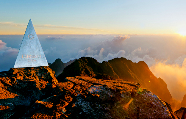
The topography of Fansipan Mountain is varied. Muong Hoa Valley, at the lowest altitude (950 – 1,000m), is created by a narrow strip of land at the base on the east side of the mountain. It is said that the Hoang Lien Mountain Range, with Fansipan Mountain as its highest peak, did not emerge in the mountainous North West of Vietnam until the neozoic period. Fansipan Mountain, a rough pronunciation of the local name “ the tottery giant rock”. The French came to Vietnam and in 1905 planted a landmark telling Fansipan Mountain 's height of 3,143m and branded it “Roof of Indochina”. Very few people climbed to the top of Fansipan Mountain at the time. Then came the long years of war and Fansipan Mountain was left deserted for hunting and savaging. The trail blazed by the French was quickly overgrown by the underbrush. It takes few days to reach the 3,143m summit, the highest peak of the Indochina Peninsula.
The summit of Fansipan Mountain is accessible all year round, but the best time to make the ascent is from mid – October to mid – November and again in March.
.jpg)
.jpg)
.jpg)
.jpg)
Why Book With Us?
GET YOUR FREE QUOTE!
All tours featured on our website are just suggested itineraries.
If you cannot find exactly what you want, INQUIRE NOW and we will get you connected with your own Travel Expert to create a bespoke itinerary just for you.